In densely populated urban environments, achieving high-precision positioning is fraught with difficulties. Traditional Global Navigation Satellite System (GNSS) technologies, particularly Real-Time Kinematic (RTK) systems, often struggle against challenges posed by multi-path signals and persistent interference from tall buildings. These factors significantly affect the accuracy and reliability of navigation solutions, thereby limiting their effectiveness in meeting the stringent demands of modern applications like autonomous driving, smart logistics, and public safety services. The inadequacies of prior methods, including Wi-Fi and Bluetooth technologies, underscore the urgent need for advancements capable of overcoming these urban barriers.
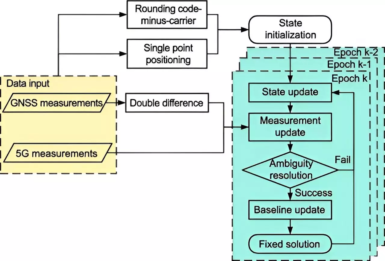
Enter 5G technology—heralded for its remarkable speed, enhanced bandwidth, and dense deployment capabilities, which together offer an innovative solution to the urban positioning dilemma. The integration of 5G with traditional satellite data marks a transformative upgrade in precision navigation systems. Researchers from Tsinghua University have developed a groundbreaking 5G-assisted BeiDou Navigation Satellite System (BDS) RTK positioning framework that addresses existing limitations. This system leverages an advanced approach, incorporating an extended Kalman filter alongside sophisticated ambiguity resolution techniques, resulting in a notable enhancement in positioning accuracy amidst the challenges posed by urban landscapes.
Breaking Down the Research Findings
Published on August 26, 2024, in the journal Satellite Navigation, the researchers meticulously assessed how the incorporation of 5G technology influences BDS RTK performance. Their analyses utilized gain factors to determine the efficacy of float solutions and ambiguity dilution of precision (ADOP). The results were striking: the new 5G-enriched system achieved a remarkable 48% reduction in spatial errors in full ambiguity resolution mode, and significant improvements were also seen in partial ambiguity resolution mode, with an 18.8% decrease in errors. Furthermore, the fixing rates—a critical metric of positioning reliability—showed notable enhancements, rising from 11.11% to 13.93% under full ambiguity resolution and from 32.58% to 44.43% in partial resolution.
The findings suggest that 5G technology has a powerful ability to mitigate the common obstacles encountered in urban navigation. As articulated by Dr. Tengfei Wang from Tsinghua University, this hybrid approach not only ameliorates existing positioning issues but also lays the groundwork for more sophisticated urban navigation strategies. The ramifications of this innovation are vast, with potential applications extending to autonomous vehicle navigation, emergency response systems, and broader smart city infrastructures.
The promising results of this 5G-assisted BDS RTK system showcase a scalable solution, ready to be implemented as 5G networks continue to expand across urban landscapes. Future research is poised to further evaluate the system’s performance in various real-world scenarios, providing opportunities for refinements that could lead to even higher accuracy and dependability. As urban environments continue to evolve, the integration of advanced technologies like 5G will be essential in shaping the future of high-precision positioning, ultimately transforming how we navigate and interact within our cities.


Leave a Reply